About Hazard Mitigation
What is Hazard Mitigation?
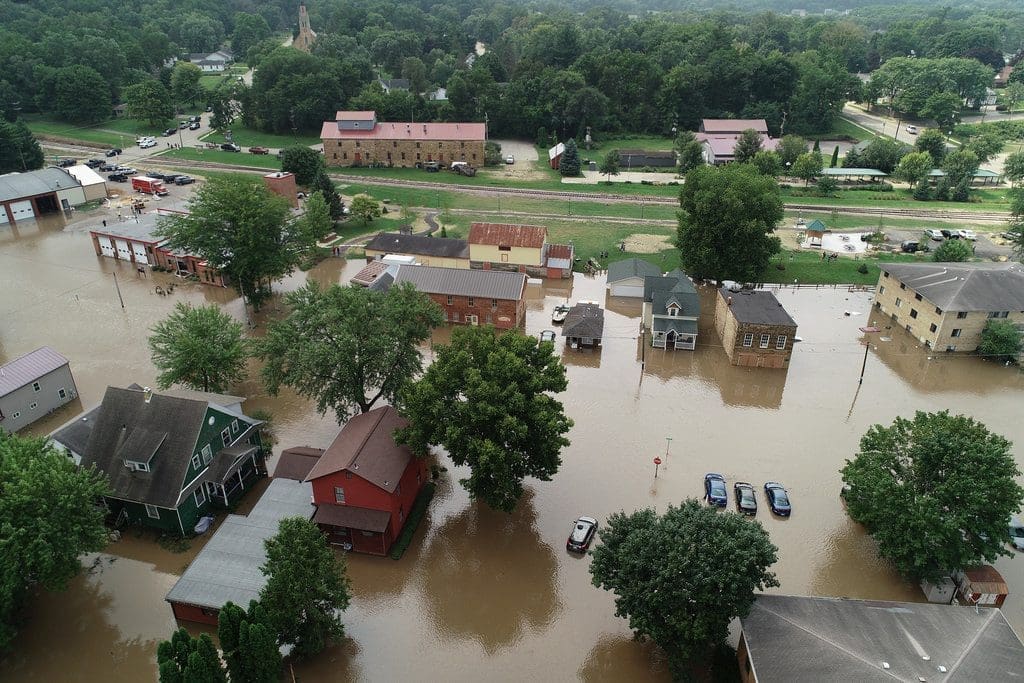
Wisconsin is vulnerable to a variety of natural hazards. The state has incurred hazard-related damages totaling nearly $3 billion in the last three decades. Hazard mitigation breaks the cycle of damage and repair by reducing or eliminating the long-term risk to human life and property from hazards. Effective mitigation actions can include a variety of projects and activities. For example, mitigation can include relatively simple projects such as elevating a home furnace, water heater, and air conditioner. Mitigation actions can also include larger and more complex projects such as relocating buildings out of the floodplain, strengthening critical facilities to prevent wind damage, and construction of detention or retention ponds.
A 2019 study by the National Institute of Building Sciences found that every $1 spent on mitigation saves an average of $6 in future reduced losses. This savings increases to $7 for FEMA-funded flood mitigation projects, like those completed in Wisconsin communities.
About Our Team
Wisconsin Emergency Management’s Hazard Mitigation Section is comprised of staff who provide technical assistance to counties, local units of government, Tribal Nations, and some types of private non-profit organizations as they navigate the FEMA Hazard Mitigation Assistance grants. We can assist with everything from applying for FEMA grants, to reviewing county/local/tribal hazard mitigation plans, to helping manage project grants to mitigate local risk. We cannot work directly with property owners – all projects must be sponsored by an eligible subapplicant (usually a local unit of government).
Please email DMAWEMHazardMitigation@widma.gov as your first point of contact regarding questions about hazard mitigation funding opportunities, project ideas, and planning initiatives.
Hazard Mitigation Resources
Guidance Documents, Policies, Review Tools, and Websites
- 2025 Hazard Mitigation Assistance Guidance
- 2015 Hazard Mitigation Assistance Guidance Addendum
- Benefit Cost Analysis Toolkit Site
- FEMA Application Resources
- FEMA Building Resilient Infrastructure and Communities
- FEMA Flood Mitigation Assistance Grant Program
- FEMA GO Site
- FEMA Hazard Mitigation Assistance Grants
- FEMA Hazard Mitigation Grant Program
- FEMA Hazard Mitigation Grant Program Post Fire
General Video Trainings
- Hazard Mitigation Grant Program Management Costs
- Hazard Mitigation Assistance Cost Share Breakdown
- National Flood Insurance Program Information for Homeowners and Renters
- FEMA GO Tutorials (Modules 1-6)
Wisconsin Hazard Mitigation Grant Programs
* Currently available grants are also listed at the bottom of this page.
Emergency Management Institute Information
Reports & Informational Resources
Coastal Hazards
Wisconsin’s Great Lakes communities experience a wide range of natural hazards that include flooding, high and low lake levels, severe storms, storm waves and storm surge, shoreline erosion, ice heaves, landslides, and rare, large edge waves (seiches). All of these coastal hazards threaten lives and property, a problem that is becoming more critical as coastal development pressures increase and potential impacts of climate change manifest themselves.
Additional information can be found at the following:
Resiliency & Climate Change
FEMA is committed to promoting resilience as expressed in recent Presidential directives, task force reports, policy statements, and the 2014-2018 FEMA Strategic Plan. FEMA encourages recipients (states) and sub-recipients (communities) of Federal grants to consider climate change adaptation and resiliency in their planning and scoping efforts.The challenges posed by climate change, such as more intense storms, frequent heavy precipitation, heat waves, drought, and extreme flooding could significantly alter the types and magnitudes of hazards faced by communities and the emergency management professionals serving them. Regardless of why the climate is changing, emergency managers have to be poised to respond to disasters and support preparedness efforts nationwide.
Additional information can be found at the following:
Wisconsin Department of Health Services Toolkits
The Wisconsin Department of Health Services has created a series of toolkits to provide information to local governments, local health departments, and citizens in Wisconsin about preparing for and responding to different weather related emergencies. These toolkits focus on providing background information, practical guidance, strategies, media releases, talking points, definitions, and useful reference materials.
Additional information and the toolkits for Extreme Heat, Flood, Winter Weather, Wildfire, Chemical Release, Algal Blooms, and Drought can be accessed at the Wisconsin Department of Health Services, Toolkits for Health Professionals, website
Storm Shelter Guidance
- FEMA’s Safe Room Resources website
- FEMA’s P-320 Taking Shelter from the Storm: Building a Safe Room for Your Home or Small Business website
- FEMA’s P-361 Design and Construction Guidance for Community Safe Rooms website
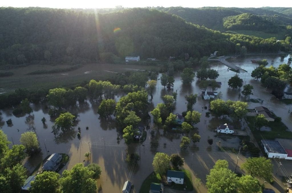
Flood of June 2008 in Southern Wisconsin
This report was prepared by the US Geological Survey (USGS) in cooperation with the Federal Emergency Management Agency. Flood peak inundation maps and water surface profiles were generated in GIS for the communities of Reedsburg, Rock Springs, La Farge, Gays Mills, Milford, Jefferson, Fort Atkinson, Janesville, and Beloit by combining flood high-water marks with available 1-10 meter resolution digital-elevation-model data. The high-water marks used in the maps were a combination of those surveyed during the June 2008 flood by communities, counties, and federal agencies and hundreds of additional marks surveyed in August 2008 by the USGS. The flood maps and profiles outline the extent and depth of flooding through the communities and were used in flood response and recovery efforts by local, county, state, and federal agencies.
The report can be downloaded from the USGS website.
Tribal Planning Resources
National Flood Insurance Program Resources
Since standard homeowners insurance doesn’t cover flooding, it’s important to purchase additional protection if your home is at risk from flooding.
Just a few inches of water from a flood can cause tens of thousands of dollars in damage. Over the past 10 years, the average flood claim has amounted to over $33,000. Flood insurance is the best way to protect yourself from the devastating financial loss that can accompany severe flooding.
The National Flood Insurance Program (NFIP) is administered by the Federal Emergency Management Agency (FEMA), which works closely with private insurance companies to offer flood insurance to property owners and renters. In order to qualify for flood insurance, a community must join the NFIP and agree to enforce sound floodplain management standards.
NFIP flood insurance policies can be purchased through property and casualty insurance agents. Rates are set and do not differ from company to company or agent to agent. These rates depend on many factors, which include the date and type of construction of your home, along with your building’s level of risk. If at risk of flooding, investing in flood insurance is the best thing you can do to protect your home, business, family, and financial security.
Typically, there’s a 30-day waiting period from the date of purchase until your policy goes into effect. That means now is the best time to buy flood insurance.
Find out more about the NFIP and how it can help you protect yourself by visiting the websites below:
Increased Cost of Compliance (ICC) Coverage
If a flood damages your property, you may be required by law to bring your home up to community and/or state floodplain management standards. If you have NFIP insurance, and your home has been declared substantially damaged by your community, ICC coverage is provided to cover up to $30,000 of the cost to elevate, flood proof, demolish, or relocate your property. ICC coverage is in addition to the coverage you receive to repair flood damages; however, the total payout on a policy may not exceed $250,000 for residential buildings and $500,000 for non-residential buildings.
Additional information can be found on FEMA’s Increased Cost of Compliance Coverage website.
National Risk Index
The National Risk Index is an online tool to help illustrate the United States communities most at risk for 18 natural hazards. The graphic below shows a down scaled version of the National Risk Index for comparison within the Wisconsin.
Resilience Analysis and Planning Tool
The Resilience Analysis and Planning Tool is a free geographic information systems (GIS) tool to help emergency managers and community partners at all GIS skill levels to visualize and assess potential challenges to community resilience. It combines population and community data (community resilience indicators), infrastructure locations, and hazard data, including real-time weather forecasts, historic disasters, and estimated annualized frequency of hazard risk.
Driving Change
Mitigation Success
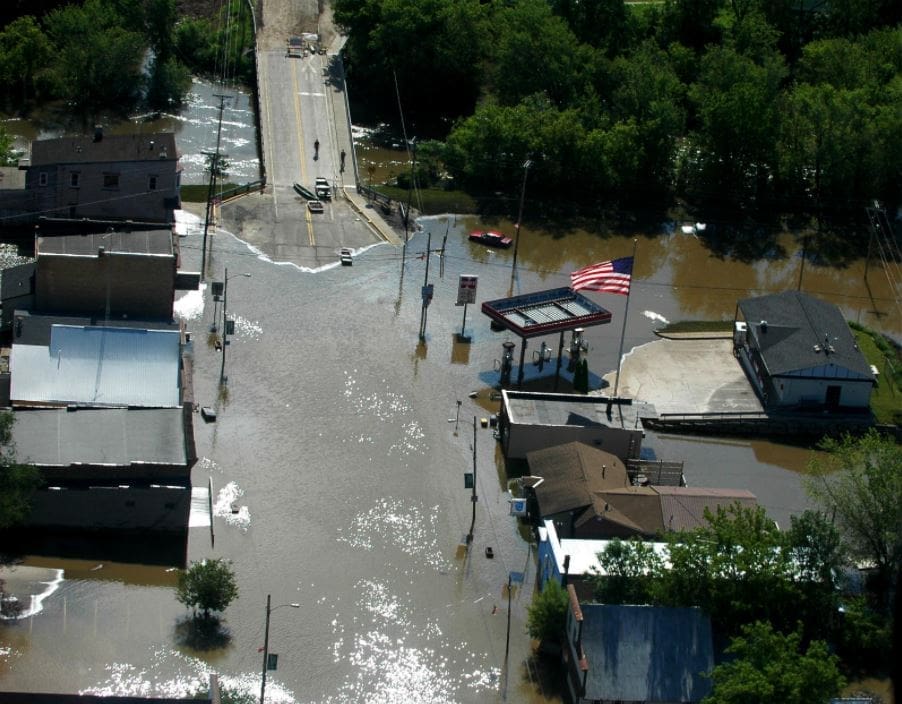
Gays Mills Sees Huge Return on Investment
The Village of Gays Mills is nestled in the Kickapoo River Valley and has a history of severe flooding. After multiple flood events in 2007,2008,2010,2016,2017, and 2018, a series of acquisition/demolition hazard mitigation projects helped the community avoid many flooding losses. The property buyouts were funded by the Hazard Mitigation Grant Program.
Rock Springs and Hazard Mitigation
The Village of Rock Springs, located along the Baraboo River in Sauk County, has participated in the Hazard Mitigation Grant Program to mitigate flooding in recent years. Property buyouts occurred following flooding in 2008 and 2018, as well as relocating the village community center.
Other Success Stories
Wisconsin communities have implemented a wide range of successful hazard mitigation projects over the years. These efforts can be applied locally to help reduce risks from natural hazards.
To request full studies, methodologies, or more details about Wisconsin mitigation success stories contact DMAWEMHazardMitigation@widma.gov.
Loss Avoidance Studies
Milwaukee Area Loss Avoidance Study (2010) In response to past flooding in Milwaukee County, local governments within the county acquired and demolished 54 repetitively damaged properties. FEMA partnered with the State of Wisconsin to complete a loss avoidance study. Five project areas were studied: the City of Wauwatosa, two areas in the City of Milwaukee, and the village of Brown Deer and Oak Creek. Benefits and calculations only include flood events up to the year 2010.
Kickapoo, Rock and Fox Rivers Loss Avoidance Study (2009) Because of frequent flooding in Wisconsin, a number of mitigation projects involving acquisiton/demolition have been implemented in the Rock, Fox, and Kickapoo Rivers. To evaluate the mitigation projects for cost-effectiveness, FEMA partnered with the State of Wisconsin to conduct a loss avoidance study. The intent of the study was to compare losses avoided in all floods since the implementation of the mitigation projects to the costs of the mitigation projects. Benefits and calculations only include flood events up to the year 2009.
FEMA Best Practices Library
Throughout the country, many individuals, businesses, and communities have been taking action to prevent disaster damages. To see how others are protecting lives and property, visit FEMA’s Mitigation Best Practices Portfolio.
Mitigation Grant Opportunities
Check back soon for more Grant Opportunities!
All available grants can be found on our grants page.