
In early April of this year, the Mississippi River began rising after a deep snowpack across its headwaters rapidly melted. According to the National Weather Service, areas along the northern tributaries of the river went from more than 20-inches of snowpack on April 1 to just a trace by mid-month. Heavy rainfall this spring led to additional runoff to the river systems in Wisconsin.
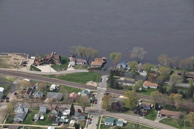
While the impacts of flooding were felt across much of the state this spring, southwestern Wisconsin was hit particularly hard. The region already holds the record as having the most expensive natural disasters in the state. Vernon, Crawford, and Grant counties were the state’s three most-flood prone counties over the past 41 years. Vernon County tops the list with 180 flooding events, followed by Grant County with 144 flooding incidents, and Crawford County with 142 flooding events.
Steve Braun has been the emergency manager in Grant County for nearly a quarter century. Since April, he has been helping communities recover from spring flooding along the Mississippi River.
“The river communities, unfortunately, are very familiar with the process,” said Braun. “We have flash flooding about every other year, and we average a federal disaster declaration every two to three years for some type of flooding since I started. It’s been quite a ride.”
Braun knows they cannot stop flooding from happening, so communities and the county have taken steps to reduce their losses.
“Mitigation has been huge here, because of our vulnerability,” said Braun. “Right when I started, I had the Mississippi River Flood of 2001, and since then we have partnered with Wisconsin Emergency Management and the Department of Administration’s Community Development Block Grant program to purchase every FEMA-identified flood prone property in the Mississippi River floodplain.”
To help communities like those in Grant County lessen mitigation costs, the Federal Emergency Management Agency (FEMA) provides funding for eligible mitigation measures to reduce disaster losses. The funding is administered through grants that can be obtained with help from Wisconsin Emergency Management.
“We help with both disaster and non-disaster mitigation grants,” said Wisconsin Emergency Management (WEM) State Hazard Mitigation Officer Heather Thole. “We assist counties and communities with the grant application process and help them determine which projects are eligible and meet FEMA requirements.”
Those requirements include looking at the feasibility of the project and environmental and historic preservation. It also includes a benefit-cost analysis, which is a method that looks at future risk-reduction by comparing the future benefits to the cost of the project.
“It’s a challenge to apply for FEMA grants because local, tribal, or county governments might not have the capacity to do it,” said Thole. “It’s a lot of work to apply for these grants and that’s why we are here to help them work through the grant process and hopefully be awarded funding.”
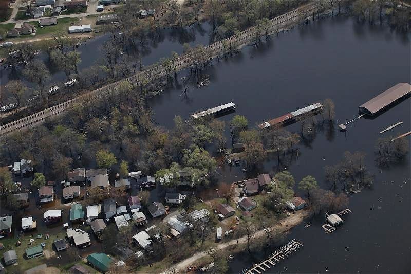
Buyouts, like those done in Grant County, offer people the opportunity to voluntarily sell their property at pre-disaster fair market value. The structure is demolished, and the land is deeded to local governments to remain open space in perpetuity. Thole said it increases the storage capacity of that floodplain and takes flood-prone structures out to avoid future damage. Sometimes those spaces can also be turned into parks or recreational courts, as long as it does not affect the floodplain.
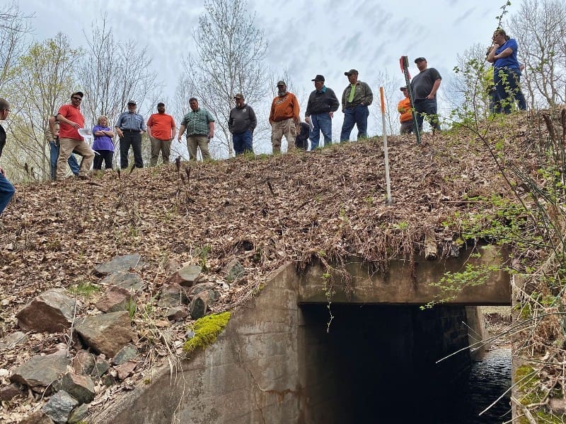
Buyouts are not the only option to mitigate flood risks. Elevating homes and even utilities can reduce damage. Another option for communities is improving infrastructure, such as upsizing culverts and floodplain storage improvement through wetland and riverine restoration. Thole said the future of flood mitigation looks green.
“Mother Nature does what it wants to do, and there is a limit to the positive impacts of gray infrastructure,” said Thole. “Green infrastructure looks at nature to slow the flow of water and mitigate local flooding.”
After major flooding in 2016 and 2018 resulted in widespread culvert blockages and road failures in Ashland County, former emergency manager Dorothy Tank looked beyond the pavement and took a deep dive into flooding impacts.
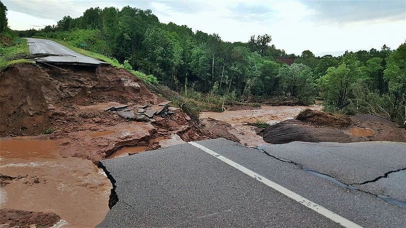
“I was in a meeting and there was a discussion on how the debris and sediment was collecting in different waterways,” said Tank. “People in that meeting were concerned about the impact to their communities if there were future heavy rainfall events.”
From 1982 to 2023, there were nearly 30 flooding events in Ashland County, according to the National Weather Service. During a six-year stretch, from 2012 to 2018, four flooding events received federal disaster declarations. Tank says the county’s geography contributes to how waterflows affect tribes and municipalities.
“It’s a very unique area,” says Tank. “The northern part of the county tends to have flash flooding because of the hilly range, and towns experience the speed and force of the water with road and culvert damage and deposit a lot of sediment. It doesn’t mean the southern part of the county never experiences flooding, but the damage there doesn’t reach the level of damage that the northern part of the county experiences.”
Following concerns in a 2018 meeting on how the watersheds were impacted by flooding, Ashland County Emergency Management and the Wisconsin Wetlands Association asked WEM for assistance in applying for a FEMA mitigation grant. The funding would be used for a study to identify debris flow hazards from flooding by studying the Marengo River watershed. The grant was awarded to the county a year later.
“This was a collaborative effort between the state and county,” said Tank. “This is the first FEMA-funded project in the state to study the overall watershed to help with flood management.”
The mitigation study helped develop new methods to evaluate how stream and watershed conditions contributed to flooding impacts. It found that not only did the fast-flowing water cause erosion in ravines and cut new stream channels, but it also stripped the surrounding landscape of the natural capacity to store and slow water flow, compounding damages downstream.
In May 2023, an addendum was added to the Ashland County Hazard Mitigation Plan. It identified six goals to reduce future flooding damage and strategies to achieve them. The goals included implementing natural flood management, reducing infrastructure failures, and ways townships can compete for more investments from disaster aid funding programs.
“The one thing about mitigation is it’s not a one size fits all process,” said Tank. “The mitigation projects that have been done in Ashland County have definitely been an improvement and are still working well.”
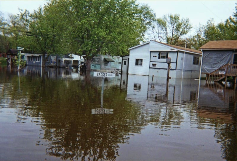
Like Ashland County, the mitigation efforts in Grant County put communities in a better position to deal with flood impacts, according to Braun. Purchasing flood-prone properties and removing them from the floodplain after the 2001 flood was a 20-year endeavor that he said paid off.
“In the 2019 flood, and then again in 2023, all of those homes would have been impacted by both of those events,” said Braun. “If the work that we’ve done in the Mississippi River floodplain did not occur, those property owners would have been displaced and had significant property damage in both of those events.”
Braun said if the buybacks did not happen, those homes would have had three to four feet of water inside.
“We have a lot of flooding risks in Grant County,” said Braun. “Mitigation has been an important tool to keep us safe and help property owners in a bad situation.”
“Hazard mitigation is a way to plan for the future and think beyond disaster response,” said Thole. “Grants can help provide mitigation funding to stop the cycle and help communities become stronger and more resilient.”
Currently, all 72 counties in Wisconsin have an all-hazards mitigation plan. They outline strategies that can be implemented by the county or local governments to reduce impacts to people, infrastructure, and the environment.
The state also has a mitigation plan that was most recently updated in 2021. It outlines the ways WEM and other state agencies help communities withstand all hazards. The next update to the State Hazard Mitigation Plan is scheduled for 2026.